
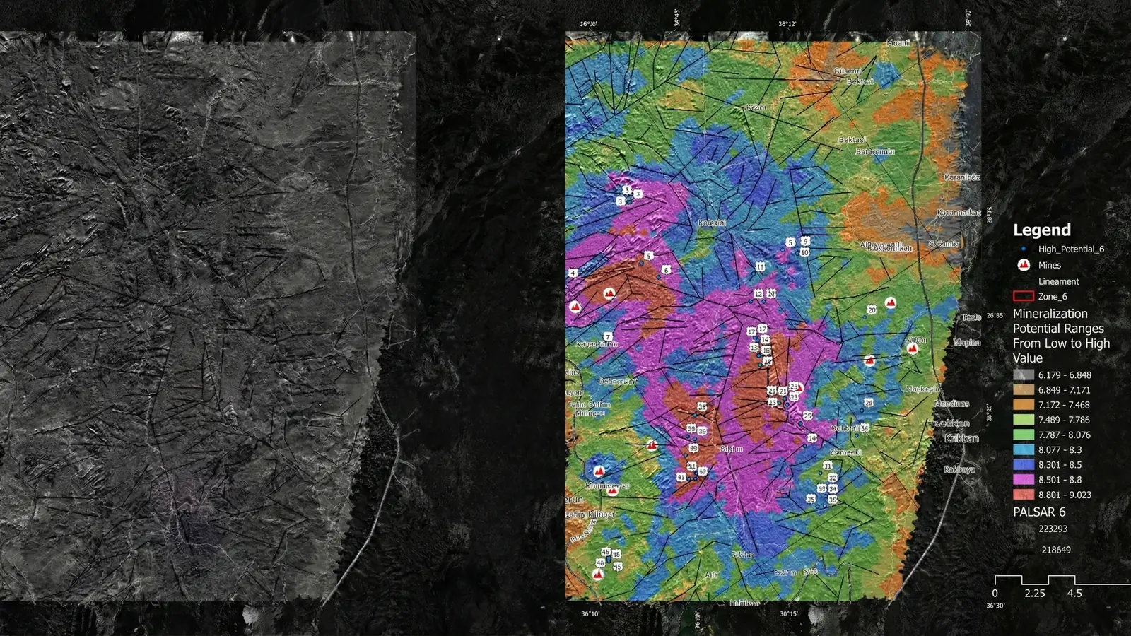
Mineral prospectivity mapping converts multiple evidence layers into a spatial view of relative exploration priority. Its purpose is to support a decision about where to investigate—not to declare that a deposit exists.
From mineral-system concept to evidence model
A prospectivity model begins with an explicit geological thesis. The team identifies the processes, controls, and observable expressions expected for the deposit style, then evaluates which available datasets can represent those concepts responsibly.
Evidence may include:
- Lithology, contacts, faults, structures, and intrusive relationships.
- Alteration-related surface responses and mineral-group proxies.
- Geochemical pathfinders and sampling context.
- Magnetic, gravity, radiometric, electromagnetic, or other geophysical evidence.
- Terrain, drainage, regolith, cover, and preservation context.
- Known occurrences, prospects, and exploration history.
Choosing an integration method
There is no single correct algorithm. Knowledge-driven weighting is useful when labels are scarce but geological logic is strong. Data-driven methods can model complex relationships when labels are adequate and bias is controlled. Hybrid approaches can combine geological constraints with statistical or machine-learning models.
| Approach | Strength | Main risk |
|---|---|---|
| Expert weighting | Transparent and usable with sparse labels | Subjective weights and hidden dependence |
| Statistical modeling | Quantifies relationships and uncertainty | Assumption and sampling sensitivity |
| Machine learning | Captures nonlinear interactions | Leakage, overfitting, and weak spatial generalization |
| Hybrid workflow | Combines constraints and flexible models | Complexity can obscure accountability |
Explainability is part of the deliverable
A target score becomes useful when the technical team can see which evidence drove it, whether that evidence is geologically plausible, and what alternative explanation remains. Feature importance or SHAP values can support that review, but they do not make a relationship causal.
Validation must be spatial and decision-aware
Known occurrences are spatially clustered and shaped by historical exploration. Validation should therefore avoid random splits that place neighboring samples in both training and testing. Spatial blocks, holdout domains, sensitivity analysis, independent occurrences, and field evidence provide a more realistic picture of generalization.
Metrics should be tied to the exploration decision. A single accuracy or AUC value is insufficient without the sampling design, class balance, threshold, uncertainty, and baseline.
What a ranked target register contains
- Priority tier and geometry.
- Principal evidence drivers.
- Confidence context and evidence completeness.
- Alternative explanation or false-positive risk.
- Data gap and recommended next observation.
- Condition that would advance, hold, or downgrade the target.
What prospectivity mapping does not establish
A prospectivity surface is not a resource model. It does not establish mineralization, grade, thickness, continuity, metallurgy, economics, or a reporting-code-compliant resource or reserve. It is a structured hypothesis about where further investigation is most justified.